


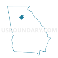
135003 - DACULA Voting District, Gwinnett County, Georgia
About
Outline

Summary
| Unique Area Identifier | 562063 |
| Name | 135003 - DACULA Voting District |
| County | Gwinnett County |
| State | Georgia |
| Area (square miles) | 8.27 |
| Land Area (square miles) | 8.23 |
| Water Area (square miles) | 0.04 |
| % of Land Area | 99.50 |
| % of Water Area | 0.50 |
| Latitude of the Internal Point | 33.99372320 |
| Longtitude of the Internal Point | -83.90337220 |
Maps


Graphs
Select a template below for downloading or customizing gragh for 135003 - DACULA Voting District, Gwinnett County, Georgia


Neighbors
Neighoring Voting District (by Name) Neighboring Voting District on the Map
- 01312 - 12 Voting District, Barrow County, GA
- 135001 - HARBINS A Voting District, Gwinnett County, GA
- 135027 - HOG MOUNTAIN B Voting District, Gwinnett County, GA
- 135028 - ROCKYCREEK A Voting District, Gwinnett County, GA
- 135071 - LAWRENCEVILLE F Voting District, Gwinnett County, GA
- 135133 - HARBINS B Voting District, Gwinnett County, GA
- 135144 - LAWRENCEVILLE M Voting District, Gwinnett County, GA
- 135152 - ROCKYCREEK C Voting District, Gwinnett County, GA
Top 10 Neighboring County Subdivision (by Population) Neighboring County Subdivision on the Map
- Lawrenceville CCD, Gwinnett County, GA (215,169)
- Dacula-Rocky Creek CCD, Gwinnett County, GA (91,691)
- Auburn CCD, Barrow County, GA (18,594)
Top 10 Neighboring Place (by Population) Neighboring Place on the Map
Top 10 Neighboring Unified School District (by Population) Neighboring Unified School District on the Map
Top 10 Neighboring State Legislative District Lower Chamber (by Population) Neighboring State Legislative District Lower Chamber on the Map
- State House District 105, GA (91,944)
- State House District 108, GA (68,282)
- State House District 104, GA (66,935)
Top 10 Neighboring State Legislative District Upper Chamber (by Population) Neighboring State Legislative District Upper Chamber on the Map
- State Senate District 45, GA (256,939)
- State Senate District 9, GA (203,621)
- State Senate District 47, GA (193,917)
Top 10 Neighboring 111th Congressional District (by Population) Neighboring 111th Congressional District on the Map
Top 10 Neighboring Census Tract (by Population) Neighboring Census Tract on the Map
- Census Tract 506.08, Gwinnett County, GA (15,422)
- Census Tract 506.07, Gwinnett County, GA (15,244)
- Census Tract 506.10, Gwinnett County, GA (14,881)
- Census Tract 505.48, Gwinnett County, GA (11,778)
- Census Tract 505.45, Gwinnett County, GA (11,641)
- Census Tract 1801.06, Barrow County, GA (2,624)
- Census Tract 1801.04, Barrow County, GA (2,016)